Italiano
 Deutsch
Cima Sospiri, Bestone e sentiero delle farfalle

This beautiful and adventurous (the final trail) loop ride kicks off above the town of Limone del #garda, precisely in the mini parking lot (3 cars) at the entrance to Val Pura. You climb hard on bitumen until the mythical Piazzale Angelini in Vesio then up the very famous as beautiful Tremalzo super bike.
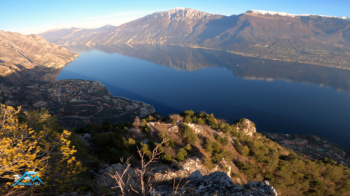
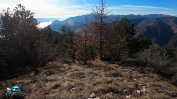
After 800 emtri of elevation gain and 9.9 km we leave the very comfortable dirt road and with a short push to the left we climb on trail to Bocca Sospiri. We proceed on trail 106 now pedaling now pushing to the junction for Fornaci C. Sospiri C.Selva taking trail 163. Again with pushing and a few pedalable segments after 280 meters of elevation gain we will be on the Sospiri summit.
There is no summit cross to indicate the maximum elevation but it is still easily spotted in addition to the navigator's indication that we are on the summit. Now it's back to the uphill trail, to call it fun is reductive, wonderful bottom, (two short detours for broken trees) and doable switchbacks but with lots of fun. So we are back on 106 towards Dega that we had left earlier and the fun continues on mostly flow trail (except gravel below Bocca Sospiri) where the bike wants to run fast.
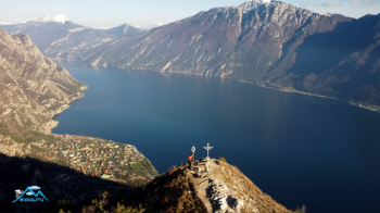
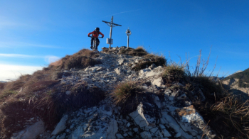
We pass the junction for Val Pura and get ready to climb hard, shouldering the bike for 150 emtri of elevation gain on the direttissima North/East of Bestone, which can be avoided by bypassing the North of Bestone on a convenient trail/forest road and taking the classic climb.
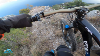
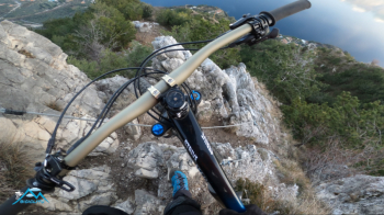
One of the most beautiful balconies of Lake Garda without a doubt. Now the gamble, we descend the De Le Farfalle trail that seems to plummet over Limone del Garda, and not only seems, in fact for long stretches it really plummets (for the cyclist). I have not found satisfactory documentation on the net, we see two steep segments on rock slaved by wire rope but the arcane to be unraveled is, what percentage is cyclable of this panoramic trail?
The answer is little, I would say 40/45% even though the parts on rock are no more than 10% the trail is often very steep with uneven bottom and close to the abyss. Normally cyclability is relative to the Biker's skills but in this case even bikers definitely better than I am I assume cannot raise the percentage in the saddle by much, so, awareness! For those who want to try it anyway, the trail has really sublime views of the lake moreover it gives the pleasant feeling of a nice adventure even if at the first place in the scale of values we will not find the cyclability.