
 Italiano
 Deutsch
Carbon Trail

The Carbon Trail is a trail that has been ridden by MTB for decades, but it jumped into the limelight about 6-7 years ago when it had become an official MTB trail. 3 years ago it was then removed from MTB trails because someone at the bottom of the trail complained about too many passes near his house. Usual backyard quarrels that do not, however, change the fact that the trail remains a hiking trail, not forbidden to bikes, and therefore legally passable by MTB.
Today I did it again, after a long time, and found it in perfect condition.
You start from Vira/Gsmbarogno and scarf down the 1100 meters of paved elevation gain to Alpe di Neggia, which would then be the pass.
Here there is both a nice fountain and a restaurant where you can get something to eat.
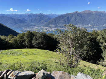
1 meter before the restaurant, on the left, the descent on trail begins. There are several serpentines, never too narrow and more or less narrow sections, until you come to a stream to cross. Here begins an ascent of about 100 meters of elevation gain that will take you to the first viewpoint
The trail continues into the woods and, after losing some more elevation gain, makes a long, partly exposed traverse. It is easy, but be careful not to hit inside the handlebars against trees and rocks on the right. One biker has already died here, falling into the cliff on the left.
This brings you to the second vantage point.
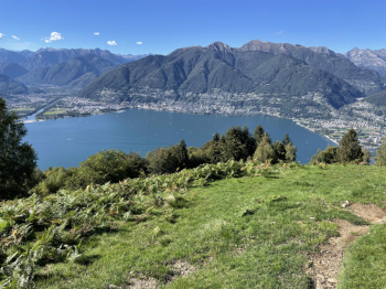
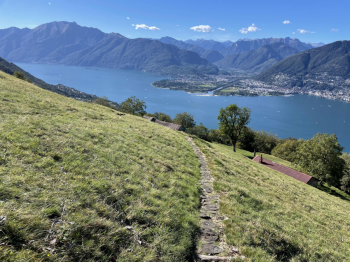
From here begins the more flow/fast part of the trail, which will take us back to Vira, not without some beautiful views of Lake Maggiore and Locarno.
Parking: all are metered in Vira.