Italiano
 Deutsch
Valle Po - Calcinere - Oncino - Monte Tivoli - giro a doppio anello

Start from Calcinere and after about 3 km of asphalt climb to the left, still on asphalt, to Oncino.
The overall tour is a double loop, clockwise to Mt. Tivoli and counterclockwise back to Oncino to descend to Calcinere.
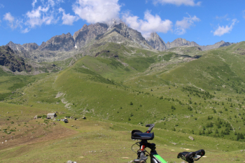
The crossroads is above Oncino with signs for meire Tirolo, Paschie, Porcili going up and signs for Bigorie and S. Ilario coming down. The dirt road section leads to the alpine pasture of Rifugio Alpetto climb to the cross. Beautiful views of the Stone King and to the right Visolotto, Punta Roma and Venezia; to the left Punta Michelis, Cima delle Lobbie, Punta delle Guglie and Punta Rasciassa. 7.5 km for 500 m elevation gain to Oncino, 11 km and 850 elevation gain to start dirt road, 13 km and 1050 at top.
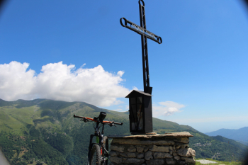
Descent: from the same side of the ascent, below Tivoli Peak, a slender little path starts that first on grass and then on the left in the woods leads with ups and downs to San Giacomo, elevation 1350 m., after 5 km and 500 meters of elevation gain from the summit. Along the way the pedaling is interrupted by wide stone gullies, a very steep climb, and a fallen tree.
Back in Oncino, elevation 1220 and km 20, climb up past the square and at the crossroads this time left on asphalt continue toward Meire Bigoire and S. Ilario, turn right and continue on dirt road leaving you climb on asphalt on the right. Continue on dirt road on false level and with some ups and downs. At a certain point veer left over a small bridge, cross the Lenta stream, take a path that continues to locality Serre. Continue uphill on dirt track until you reach a hairpin bend to the right where you veer onto grassy path to a rock from which a fairly anonymous sign indicates the descent.
It is a descent into the woods on a slender but compact track that then diverges with hairpin bends toward the Calcinere penstocks. The trail passes through some huts and reaches the small church of San Pietro and then a dirt road to lower Calcinere.
Fraternali publisher no. 10 Po Valley, Monviso Trail map (1:25,000)