Italiano
 Deutsch
Col Vert - ring from Arnad and Verrès

The trail was created for hikers; some signs indicate the total distance in 4 hours, which is about how long it takes to do the mtb tour, including stops and photos.
So this is a half-day trail, to be avoided after rain and during hot hours.
Signage is obvious, always trail No. 3 uphill, downhill from Fornelle trails No. 2 and No. 3 are coincident until just after Barmelongue where you must follow No. 2 to a junction.
In Arnad you can also find parking lots along the main SS 26 road (e.g., Supermarket Crai) , and continue by mtb on asphalt until you reach Verres to start climbing with immediately steep gradients toward Verrès Castle. Three km are flat and nine km are uphill for a total elevation gain of 1050 m, fortunately 95 percent on asphalt and with dense vegetation.
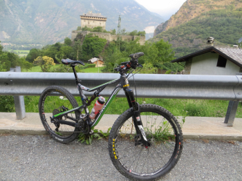
As we climb we cross several hamlets, Località Casset, Rovarey, Polarey, Vert. The first hamlets magnificently overlook the Castle of Verres.
The descent sign to Col Vert is very obvious, taking a wide, completely grassy road to Fornelle m.1290.
Here too the signs are unmistakable, you descend along the retaining wall to the left and continue on little path often with bike at your side due to sometimes rocky and quite disconnected terrain. After Barmelongue, at a fork in the woods continue on the less defined path to the right to get to Salè (intentionally in the trail there is a drool after Barmelongue to indicate the exact point of the fork, a marked stone in the woods) .
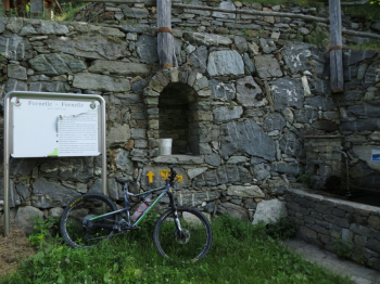
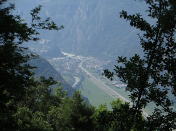
Continue on asphalt for about a km and then take a dirt road to Avieil. In the center of the hamlet there is a fountain, you have to continue on the left and take the mule track: it is a cobblestone at first very wide, perhaps the most enjoyable part is the final part where it narrows a bit. On the descent, spectacular views of the Fortress of Bard.
The Hiker Publisher No. 12 Basse Valli d'Ayas e del Lys - Trail map (1:25,000)