
 Italiano
 Deutsch
Moschera

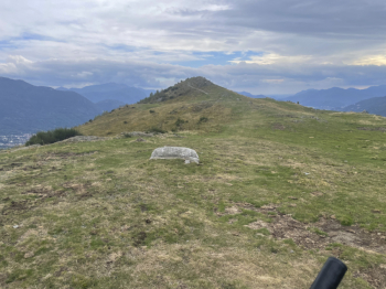
Short but tough ride that leads from Tesserete to the top of one of the mountains above it. The climb is mostly paved/cemented until you reach Condra, from where a singletrack starts to be pedaled slightly uphill. You descend to a house, with a nice fountain in front of it, and from there start climbing steeply again. Before the final climb to Moschera there is a short descent, then climb again and you reach the viewpoint.
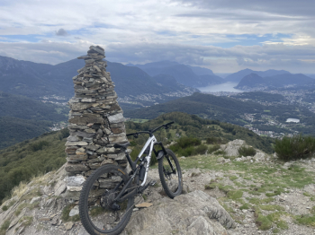
Moschera is where the pile of stones my bike is leaning against is located. The view sweeps across the entire Lugano area.
NB: all these trails are frequented by pedestrians especially on weekends, so don't go down predicting to do the race or the KOM f**k. Enjoy the trails and brake if there are people.
The descent to Condra is a unique sassaia, made worse by last summer's torrential rains.
From Condra to the parking lot at Condra houses is rockier and less stony.
From the parking lot the trail follows a path that has a bike ban sign at its beginning, a gentle reminder because of someone who wanted to have an enduro race here. In any case, the prohibition is not supported by any municipal law, so if you get in trouble, continue on the paved road until you meet the trail again, otherwise dive into the trail, which is also the most trialistic and technical of all.
We arrive at Bigorio Convent, where we briefly climb back onto the paved road before taking the last trail of the tour, the Favessa. Stringy and never steep, it is great fun and takes us back just above Tesserete.