
 Italiano
 Deutsch
2022/10/02 16:26:01
BIVACCO DEI LOFF
Author
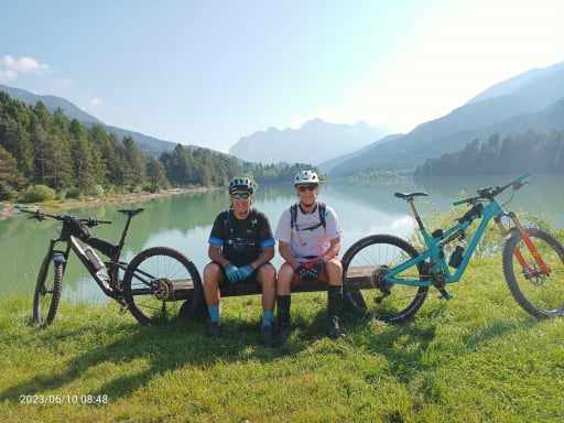
Place
Italy - Veneto
Km
41,07 km
Elapsed time
-462223:-32:-1
Vertical meters
+1 790 mt (0 - 1222)
Route difficulty
Landscapes
Last update
2023/01/03 16:14:57
Comments
Description
It is a modified version of this old route.
1st change: at wpt D, instead of continuing uphill to La Posa and Cimone, descend briefly to wpt E and resume climbing on the Caldella road
2nd modification: not descend to the San Boldo pass but to Signa
3rd change: the climb from Signa to Casera Costa Curta, the section from wpt L to wpt M is particularly steep and will require walking about 10/15 minutes, it is about 200m climb.
4th modification: descent to Praderadego Pass, very hollowed out by water, pay attention to the gullies.
Graph
Nearest Routes
31,13 km
Km
+1 600 mt
Vertical meters
Route difficulty
Landscapes
69,55 km
Km
+2 700 mt
Vertical meters
Route difficulty
Landscapes
60,12 km
Km
+2 250 mt
Vertical meters
Route difficulty
Landscapes
21,32 km
Km
+1 000 mt
Vertical meters
Route difficulty
Landscapes
24,28 km
Km
+1 200 mt
Vertical meters
Route difficulty
Landscapes
26,20 km
Km
+1 200 mt
Vertical meters
Route difficulty
Landscapes
24,38 km
Km
+1 300 mt
Vertical meters
Route difficulty
Landscapes
51,90 km
Km
+1 800 mt
Vertical meters
Route difficulty
Landscapes
68,76 km
Km
+2 350 mt
Vertical meters
Route difficulty
Landscapes
44,72 km
Km
+1 723 mt
Vertical meters
Route difficulty
Landscapes