HOME RANKINGS CHALLENGES ROUTES POI PLANNING SEARCH LOGIN
Italy - Valle d'Aosta, AO
2022/10/03 19:32:53

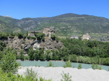
Petit Poignon - ring from Villeneuve and Aymavilles

6 Downloads
0
 
Author
gmzolenart
(104)
Place
Italy - Valle d'Aosta, AO
Km
18,80 km
Elapsed time
04:21:47
Vertical meters
+1 062 mt (654 - 1561)
Route difficulty
Landscapes
Last update
2022/10/03 20:00:36
Comments
0
Description

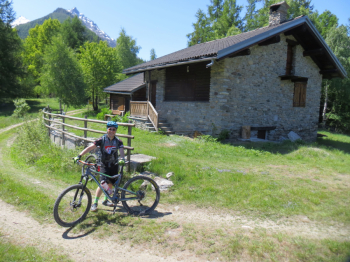
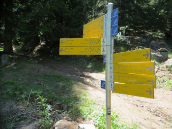
Start from Villeneuve on asphalt southbound and all asphalt for 5 km to Champlong. Continue by wide dirt road always in the forest on trail marker 1 with very few forks, one of the few to avoid leads to Chevrére. From the plateau of Petit Poignon (1560 m) the view opens to the entrance of the Cogne valley, then to Grivola and Gran Nomenon.

The first part of the descent on trail 2, perfectly marked, is OC+ in places, rough rock, then BC. The direction is east toward Pont d'Ael.

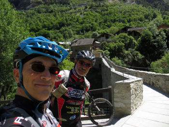
You arrive at Le Pont d'Ael Pont (880 m), particular for its bridge-aqueduct from Roman times; the upper part was used for water passage and the lower part for walking people and animals. It was a rare case of a private aqueduct for industrial purposes, namely the extraction and processing of bardiglio marble in the quarries located further downstream. (cit. site lovevda-culture-architecture-roman-bridge-aqueduct)

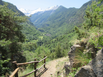
Heading north with partly rideable sections, proceed on little path to a final steep before a tunnel, lit.

Downhill section, then asphalt, then on the right trail 2 begins again in Eissogne to Aymavilles.

From here on asphalt back to Villeneuve.

The hiker editor no. 4 Conca di Aosta Mont Emilius Mont Fallère - Trail map (1:25,000)


Download our free mobile app to send this route to your Garmin device or to navigate it on OSM maps. Android - iOS

Graph

Nearest Routes

2022/10/04
- Italy - Valle d'Aosta, AO
gmzolenart
(104)
23,03 km
Km
+1 249 mt
Vertical meters
Route difficulty
Landscapes
2023/07/31
- Italy - Valle d'Aosta, AO
Staff
(13)
19,82 km
Km
+1 030 mt
Vertical meters
Route difficulty
Landscapes
2023/06/10
- Italy - Valle d'Aosta, AO
marco
(102)
7,95 km
Km
+141 mt
Vertical meters
Route difficulty
Landscapes
2022/09/30
- Italy - Valle d'Aosta, AO
gmzolenart
(104)
28,02 km
Km
+1 315 mt
Vertical meters
Route difficulty
Landscapes
2022/08/22
- Italy - Valle d'Aosta, AO
nonnocarb
(266)
14,66 km
Km
+693 mt
Vertical meters
Route difficulty
Landscapes
2022/09/18
- Italy - Valle d'Aosta, AO
yura
(7)
33,33 km
Km
+1 880 mt
Vertical meters
Route difficulty
Landscapes
2022/09/09
- Italy - Valle d'Aosta, AO
marco
(102)
23,16 km
Km
+742 mt
Vertical meters
Route difficulty
Landscapes
35,44 km
Km
+1 900 mt
Vertical meters
Route difficulty
Landscapes
2022/08/22
- Italy - Valle d'Aosta, AO
nonnocarb
(266)
21,55 km
Km
+630 mt
Vertical meters
Route difficulty
Landscapes
2022/08/31
- Italy - Valle d'Aosta, AO
21,35 km
Km
+1 334 mt
Vertical meters
Route difficulty
Landscapes

0 Comments