HOME RANKINGS CHALLENGES ROUTES POI PLANNING SEARCH LOGIN
Italy - Trentino-Alto Adige/Südtirol, TN
2022/10/04 09:18:09

Tremalzo

124 Downloads
4
 
Author
marco
(102)
Place
Italy - Trentino-Alto Adige/Südtirol, TN
Km
57,38 km
Elapsed time
05:15:31
Vertical meters
+2 164 mt (74 - 1794)
Route difficulty
Landscapes
Last update
2023/10/31 10:56:33
Comments
0
Description

Fantastic ride on the west shore of Lake #garda. Worth it even just for the climb.

We start with the beautiful Ponale route, overlooking the Lake, and recently refurbished. You arrive at Pregasina where the slopes begin to steepen to Malga Palaer. From here the trail up to Passo Rocchetta has recently been fixed, becoming rideable uphill without any problems.

From Passo Rocchetta up to Passo Nota is a long traverse with several ups and downs, and with the possibility of getting water at a little house along the trail/road. Leave a donation, as someone buys and brings up the small bottles.

Refreshments are also available at Nota Pass, when the hut is open.

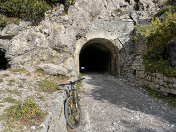
From the Nota Pass to the Tremalzo Pass follow the beautiful military road, all dirt, with its countless switchbacks. Once you reach the highest tunnel, you have made it, you are at the top.

However, the climbs are not over, in fact once you reach Rifugio Garibaldi you turn right and climb a bit before starting the descent to Valle di Ledro. Initially on a dirt road, then on a nice path (be careful to catch the detour, in a hairpin bend to the right!) that unfortunately ends high above the valley and turns into a cemented road that takes us to Lake Ledro. You skirt it and then take to the bike path that leads toward Riva, to abandon it and cut across a rocky path to the Ponale from which we climbed at the beginning of the tour.

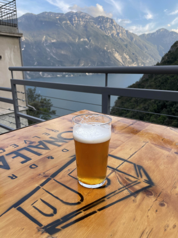
From here you have two options: take the trail in front of you (the famous Trout) or go enjoy a well-deserved beer at the bar along Ponale. I opted for the latter solution, and I highly recommend it.

Download our free mobile app to send this route to your Garmin device or to navigate it on OSM maps. Android - iOS

Graph

Nearest Routes

2023/01/15
- Italy - Trentino-Alto Adige/Südtirol, TN
Seraffo85
(13)
36,39 km
Km
+1 342 mt
Vertical meters
Route difficulty
Landscapes
2022/12/05
- Italy - Trentino-Alto Adige/Südtirol, TN
marco
(102)
25,12 km
Km
+1 045 mt
Vertical meters
Route difficulty
Landscapes
2022/12/10
- Italy - Trentino-Alto Adige/Südtirol, TN
Giulien
(110)
33,62 km
Km
+1 462 mt
Vertical meters
Route difficulty
Landscapes
2023/05/07
- Italy - Trentino-Alto Adige/Südtirol, TN
giannig
(17)
38,95 km
Km
+1 700 mt
Vertical meters
Route difficulty
Landscapes
2022/12/16
- Italy - Trentino-Alto Adige/Südtirol, TN
Giulien
(110)
40,35 km
Km
+2 000 mt
Vertical meters
Route difficulty
Landscapes
2022/12/16
- Italy - Trentino-Alto Adige/Südtirol, TN
Giulien
(110)
46,69 km
Km
+1 850 mt
Vertical meters
Route difficulty
Landscapes
28,31 km
Km
+1 448 mt
Vertical meters
Route difficulty
Landscapes
2022/10/04
- Italy - Trentino-Alto Adige/Südtirol, TN
marco
(102)
37,96 km
Km
+1 409 mt
Vertical meters
Route difficulty
Landscapes
2023/04/29
- Italy - Trentino-Alto Adige/Südtirol, TN
marco
(102)
33,54 km
Km
+1 362 mt
Vertical meters
Route difficulty
Landscapes
2022/10/04
- Italy - Trentino-Alto Adige/Südtirol, TN
marco
(102)
14,30 km
Km
+446 mt
Vertical meters
Route difficulty
Landscapes

0 Comments