Italiano
 Deutsch
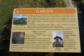
Fort of La Croix de Bretagne, Lake of Orceyrette, vs Col des Ayes, Le Melezin

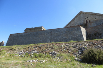
From Villar Saint Pancrace follow the signs for Chapelle Saint Pancrace, and then to the left "Rue de la Croix de Bretagne," to the last houses of the village. You pass a large paved square, and continue along the road, which becomes unpaved. After the first ramp you come to a fork in the road, do not continue flat on the left, but on the hairpin bend to the right (with no cars allowed,this Fort is still state property). The military road climbs steadily with gradients between 8-10% on a sometimes uneven surface, into the forest with a long series of hairpin bends (there are about 23 in total), until a striking passage with the mule track cutting through a rock face. The final ramps lead directly to the entrance of the fort de la Croix de Bretagne (elevation 2000 m.). Enter the fort by crossing the wooden footbridge (check its condition) and ride on grassy track on the various levels of the fort until you reach the top.
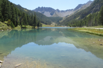
Descent: descend on the road already traveled until just before Fort de la Croix Bretagne, to the left fork (Arrows and pink bolts) where a challenging single-track, first earthy and then stony, leads to the valley floor. Passing a wooden bridge over the stream, you arrive at the roadway that leads uphill to the village Chalets des Hayes (water point present). From here about 3 km of uphill switchbacks lead to Lac de l'Orceyrette.
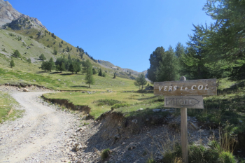
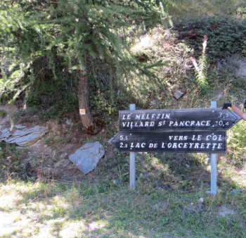
You circumnavigate the lake and, on the opposite side of the ascent, on small path to the orographic right of the' stream you reach Plan du Peyron. Here a 300 m dsl variant has been added, a loop up to Gite de Vers le Col des Ayes (2140 m.) of the long climb to Col des Ayes. You then return to Chalets des Ayes and from here climb (200 m. approx. dsl) a dirt road in the direction of Le Melezin. Between the houses starts a beautiful single track ( watch the track, several times it cuts paths) that with numerous parabolic hairpin bends and with modest gradients leads back to Villar Saint Pancrace. Notes: few water points!
Fraternali publisher no. 21 Briancon, Vallée de la Guisane, Vallée de la Clarée - Trail map (1:25,000)