Italiano
 Deutsch
Alta Val Sangone - Giaveno - Braida -Bione - sentiero 435 e 425

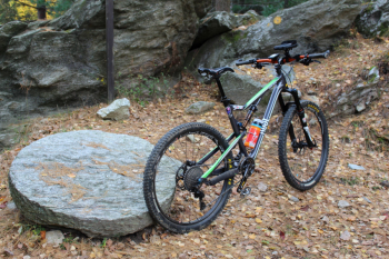
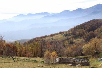
Nice low-elevation autumn trail. Set off from Giaveno in the direction of Selvaggio with some off-state sections, to the Sanctuary of Our Lady of Lourdes and Borgata Molino 720 m; this was the millstone area; there was already a mill in Coazze in 1272. Resumed dirt road at Borgata Barrera, follows climb with some challenging ramps to Pian Aschiero, then a nice stretch of technical trail after Case Bagagera, to descend again to Borgata Tortorello and then on asphalt to Colle Braida.
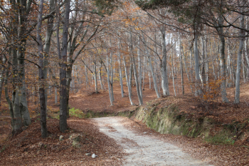
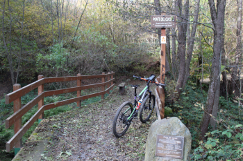
Trail 435 begins with the long dirt road into the beech forest to then follow on a false level to the three roc from which trail 425 a. The beech forest has been planted, is well maintained and spaced out, was used in construction, as heating fuel and household accessories. In the vicinity of Presa Brunetto one must avoid both the steep path that goes up and the one that goes down, one must take the thinner path halfway up to the junction that leads right to Colle Bione and left to descend on trail 425.
Because of limited time I avoid going to and from Colle Bione, I begin the descent of 425 . On this side there is widespread chestnut vegetation, the wood was used to make tubs, butter churns and buckets. First trialistic section, as bubetta says, then bc or s2 whatever with roots and firm bottom, very few switchbacks. From Pianermo to Borgata Mattonera easy mc on compact bottom with foliage. In Mattonera di sotto hemp sativa was grown, typical of Coazze since the 1400s, Coazze cloth was traded as far as beyond the Alps. In Mattonera di sotto there subsists a tank for soaking hemp; in Coazze in the Ecomuseum ancient hand looms are preserved. From Mattonera you descend into a small valley and continue with short sections of fixed stones to arrive near Coazze.
The Pirandello trail begins, dedicated to the man who also wrote notes, the notebooks, and the stay in the Coazze notebook was commemorated as a centennial in 2001. It is a well-marked trail for hikers and cycle hikers in the dense woods above Coazze with a series of footbridges including the Cuckoo Bridge. With additional short sections of trail and intermittent pieces of asphalt, you return to Giaveno.
Fraternali publisher no. 6 Pinerolese Val Sangone Trail map (1:25,000)