Italiano
 Deutsch
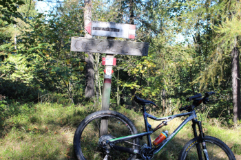
Viu' Valley-Cialmetta Pass(from Fubina)-trails 204B and 135A

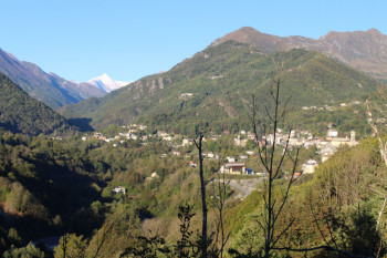
From Fubina, in the background the snow-capped M. Rocciamelone, in 3.5 km you reach Viù, continue on asphalt in the direction of Alpe Bianca, Tornetti and Asciutti , 12.5 km to the beginning of the dirt road (730 meters elevation gain) . In between hamlets of Polpresa, Asciutti ? Cappella San Bartolomeo (restorations 2018 www.civico20news.it/mobile/articolo.php?id=29544) , Colle della Dieta that separates Viù from Mezzenile.
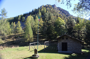
Trail 204 b begins, a dense beech forest to be hiked along the ridge. You reach the Cialmetta pass m.1,303 with the Chapel of St. Michael the Archangel and a view of Uja di Calcante m. 1,614.
Descending beautiful close-up views of M. Torretta del Prete and Punta Sbaron, Punta Grifone, M. Ciarm, Crest Montù, M. Ciorneva, M. Marmottere.
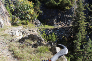
Trail 135 a is a beautiful forestry mule track with first section a bit narrow and airy, a compulsory uphill section on foot, then rideable in the woods with stone drainage cuts and some narrow switchbacks. The rio di muticheri and rio muande (on unionealpigraie.it), tributaries of the Stura di Viù in turn a tributary of the Stura di Lanzo, are crossed.
Finally at crossroads, straight stretch on Fubina.
Nice autumn solo tour.
Cartography: Fraternali Editore 1:25000 No. 9 Basse Valli di Lanzo
Toward Viù, view of Rocciamelone
Cialmetta Pass and Uja di Calcante