HOME RANKINGS CHALLENGES ROUTES POI PLANNING SEARCH LOGIN
Italy - Trentino-Alto Adige/Südtirol, BZ
2022/10/30 09:00:14

Madriccio Pass

12 Downloads
0
 
Author
nonnocarb
(266)
Place
Italy - Trentino-Alto Adige/Südtirol, BZ
Km
72,93 km
Elapsed time
09:16:29
Vertical meters
+2 970 mt (674 - 3112)
Route difficulty
Landscapes
Last update
2022/10/30 09:43:07
Comments
0
Description

Very challenging itinerary if done completely by pedaling, possibly to be split into two days. If done by ebike or if you are very well trained, it can still be done in one day and fully pedaled, except for a few dozen meters before the pass, which is why it is called the highest bike pass in Europe.

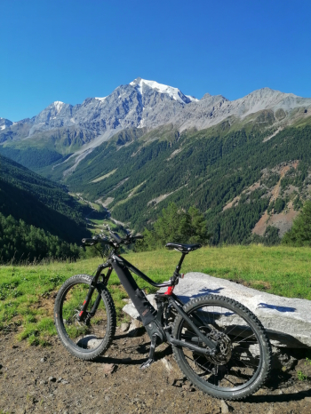
Start from the village of Morter at the bottom of the Martello valley and take the bicycle path to Prato allo Stelvio (you can take the train if necessary). From Prato you climb by forestry to the Valnera hut, then descend to Solda along the technical trail.

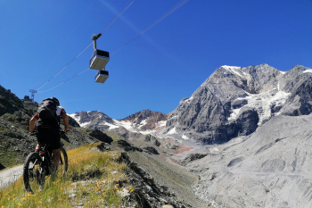
From Solda go up to the Milano hut passing under the cable car, this road is very steep, but with a good workout you can ride (alternatively go up by cable car).

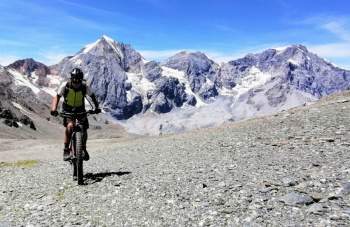
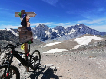
From the refuge you climb up to the pass, even in this section some people push and some manage to pedal to the top. At the pass the views are amazing of the Ortles and Grand Zebrü.

The descent is at times very technical but beautiful until the Corsi ref.

From here again not easy trail to the lake, then more trail.

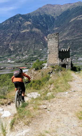
When you get to the road, it is better to follow it for a couple of km, because the path is hardly cyclable, and then follow 36 down to the valley. If you still have strength, at the end do the trail past Obermontani Castle, a last treat for a spectacular route.


Download our free mobile app to send this route to your Garmin device or to navigate it on OSM maps. Android - iOS

Graph

Nearest Routes

2022/10/26
- Italy - Trentino-Alto Adige/Südtirol, BZ
nonnocarb
(266)
32,13 km
Km
+2 033 mt
Vertical meters
Route difficulty
Landscapes
27,47 km
Km
+1 500 mt
Vertical meters
Route difficulty
Landscapes
28,35 km
Km
+1 500 mt
Vertical meters
Route difficulty
Landscapes
2023/03/07
- Italy - Trentino-Alto Adige/Südtirol, BZ
nonnocarb
(266)
37,04 km
Km
+1 770 mt
Vertical meters
Route difficulty
Landscapes
2023/03/04
- Italy - Trentino-Alto Adige/Südtirol, BZ
nonnocarb
(266)
26,12 km
Km
+1 250 mt
Vertical meters
Route difficulty
Landscapes
2023/03/07
- Italy - Trentino-Alto Adige/Südtirol, BZ
nonnocarb
(266)
51,34 km
Km
+980 mt
Vertical meters
Route difficulty
Landscapes
2023/06/01
- Italy - Trentino-Alto Adige/Südtirol, BZ
Robibz
(19)
31,15 km
Km
+1 173 mt
Vertical meters
Route difficulty
Landscapes
2023/03/04
- Italy - Trentino-Alto Adige/Südtirol, BZ
nonnocarb
(266)
45,04 km
Km
+1 520 mt
Vertical meters
Route difficulty
Landscapes
2022/08/22
- Italy - Trentino-Alto Adige/Südtirol, BZ
nonnocarb
(266)
30,40 km
Km
+1 865 mt
Vertical meters
Route difficulty
Landscapes
2023/03/04
- Italy - Trentino-Alto Adige/Südtirol, BZ
nonnocarb
(266)
28,35 km
Km
+1 500 mt
Vertical meters
Route difficulty
Landscapes

0 Comments