Italiano
 Deutsch
Lower Susa Valley - PATH 571

Beautiful trail 571 that from the slopes of Mount Rocca Sella descends to Villar Dora.
We start from Villar Dora towards the Castle , from Almese street we turn left into San Martino street and then Roccasella road that leads us on asphalt passing through the hamlets Montecomposto and Bert in about 8 km to Celle gaining 750 m elevation gain. From Celle we climb again on asphalt to the hamlet of Combe, where there is a fountain and the 'beginning of Tramontana path No. 575 to Roccasella, one of many paths.
Descent. You return to Celle and, with a small cut, to the hamlet of Case Inferiori where trail 571 begins: you keep left proceeding through dense forest with stones and foliage, always with excellent grip and good signage.
You reach the hamlet of Sala and with a short asphalt stretch you reach San Pancrazio from which another stretch of trail in the woods, a few forks and keeping left, up to Borgata Torre del Colle road from which you return to Villar Dora.
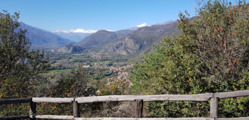
Nice trail to avoid only in summer, good exposure, nice views: from San Pancrazio view of the opposite side of the Lower Susa Valley and in? order Punta dell'Ancoccia, Monte Ciabergia (see my routes 28 and 29) and Monte Pirchiriano (better known as Sacra di San Michele). In Orsiera Rocciavrè Park the Punta Costa Bruna, Cristalliera, Punta Pian Paris, Colle del Villano, Punta Rocca Nera. Finally Giusalet, Rocciamelone, Rocca Patanua and Rocca Sella.
Fraternali publisher no. 4 Bassa Val Susa, Musinè, Val Sangone, Collina di Rivoli Trail map (1:25,000)
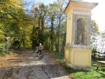
Celle
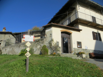
Combe hamlet
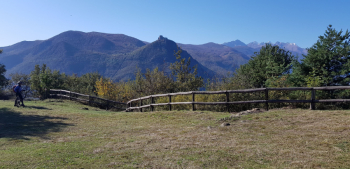
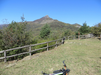
View of Rocca Sella
Punta dell'Ancoccia, Mount Ciabergia and Mount Pirchiriano (better known as Sacra di San Michele). In Orsiera Rocciavrè Park the Punta Costa Bruna, Cristalliera, Punta Pian Paris, Colle del Villano, Punta Rocca Nera.