
 Italiano
 Deutsch
Sciarborasca anello del Beigua
Proposed here, in my opinion, is the best possible tour of the Beigua massif to the south. The best time to tackle it is in spring, making sure that the various snowfields at the top have completely melted otherwise it becomes almost impossible to proceed. Fall is also a good season to hike this trail, with the bright colors from the forest trees contrasting the blue sky and sea.
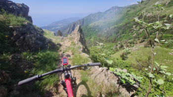
Departure from Sciarborasca, a town located inland from Arenzano. You start and find yourself almost immediately in a Mediterranean environment, and after 3-4 km the ascent into the forest begins on asphalt stretches first and then forest. You pass the villages of Deserto and Faie, and from here you start to run double-digit tears on dirt roads until you come out of the woods and can admire a splendid view towards Varazze. You still climb until you reach the Prato rotondo refuge and the Alta Via dei monti Liguri, AVL, Prato rotondo - Faiallo section.
Here begins a stretch with ups and downs that is always cyclable until the crossroads near Bric Resonau, where you take a left and leads us to the next Argentea refuge. In this section you will often have to descend and push and/or carry the MTB because of the badly tanned terrain with large boulders and diggings. It is not particularly tiring to carry the bike on your back as the climbs are not very hard, but rather short. At the hut possibility to find food and/or eat with nice view of the sea. And here begins the descent, all bikeable except for a few passages too dug by various creeks. We descend on narrow path sometimes a little bit exposed to the Gava pass.
From here begins a wider trail that takes us to the start of the first DH, Bassa Tensione, a nice fun flow. This is followed by Lerone and Ratte, to return to the bituminous Lerca highway that takes us back to the start after a few miles
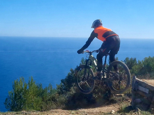
Note: As you notice in the photo of a particularly striking passage, I took XC instead of AM to favor the uphill section. I generally recommend "sturdy" and/or insert tires to avoid pinching given the "angular" terrain, formed mostly of magmatic rocks. I don't recall any water sources except at the two refuges.