HOME RANKINGS CHALLENGES ROUTES POI PLANNING SEARCH LOGIN
Italy - Trentino-Alto Adige/Südtirol, BZ
2022/11/04 21:09:44

Croce di Kinig

5 Downloads
0
 
Author
nonnocarb
(266)
Place
Italy - Trentino-Alto Adige/Südtirol, BZ
Km
32,17 km
Elapsed time
463168:22:23
Vertical meters
+1 852 mt (300 - 2075)
Route difficulty
Landscapes
Last update
2023/01/03 15:52:22
Comments
0
Description

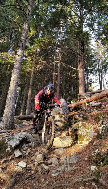
Very challenging route, both because of the steep and technical ascent, the very challenging descent, and the pushing section to get to the Cross. In cmpenso very fun and very scenic, especially in the upper part. Ideal to be ridden by ebike, given the gradients. With regular bike many pushing sections.

From Merano one ascends to the Ivigna refuge by many paths. From here first on the meadow and then on a poorly marked section of trail to the beautiful Kinig cross with magnificent views.

You descend back to the hut and ascend to the Lanzwiesen junction, with a nice false-flat path.

Now begins the very long descent, on various trails of all difficulties to Merano. Toward the end you pedal on the Waalweg, a very popular hiking trail. Best to ride it only towards evening and not in high season.


Download our free mobile app to send this route to your Garmin device or to navigate it on OSM maps. Android - iOS

Graph

Nearest Routes

2023/03/06
- Italy - Trentino-Alto Adige/Südtirol, BZ
nonnocarb
(266)
32,34 km
Km
+1 500 mt
Vertical meters
Route difficulty
Landscapes
2023/03/01
- Italy - Trentino-Alto Adige/Südtirol, BZ
nonnocarb
(266)
86,66 km
Km
0 mt
Vertical meters
Route difficulty
Landscapes
2023/03/01
- Italy - Trentino-Alto Adige/Südtirol, BZ
nonnocarb
(266)
49,83 km
Km
+950 mt
Vertical meters
Route difficulty
Landscapes
2023/03/04
- Italy - Trentino-Alto Adige/Südtirol, BZ
nonnocarb
(266)
71,35 km
Km
+1 830 mt
Vertical meters
Route difficulty
Landscapes
2022/11/01
- Italy - Trentino-Alto Adige/Südtirol, BZ
nonnocarb
(266)
42,55 km
Km
+2 157 mt
Vertical meters
Route difficulty
Landscapes
2023/03/01
- Italy - Trentino-Alto Adige/Südtirol, BZ
nonnocarb
(266)
53,70 km
Km
+1 570 mt
Vertical meters
Route difficulty
Landscapes
2023/03/05
- Italy - Trentino-Alto Adige/Südtirol, BZ
nonnocarb
(266)
31,25 km
Km
+1 100 mt
Vertical meters
Route difficulty
Landscapes
2022/10/22
- Italy - Trentino-Alto Adige/Südtirol, BZ
nonnocarb
(266)
65,78 km
Km
+2 336 mt
Vertical meters
Route difficulty
Landscapes
2022/11/21
- Italy - Trentino-Alto Adige/Südtirol, BZ
nonnocarb
(266)
41,95 km
Km
+1 783 mt
Vertical meters
Route difficulty
Landscapes
2023/03/02
- Italy - Trentino-Alto Adige/Südtirol, BZ
nonnocarb
(266)
51,00 km
Km
+1 610 mt
Vertical meters
Route difficulty
Landscapes

0 Comments