
 Italiano
 Deutsch
2022/11/06 21:14:45
Tremalzo, 222, 123
Author
Place
Italy - Lombardia, BS
Km
43,22 km
Elapsed time
05:30:03
Vertical meters
+2 069 mt (127 - 1832)
Route difficulty
Landscapes
Last update
2023/10/31 10:52:13
Comments
Description
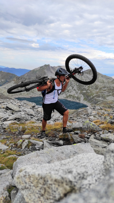
We start from Limone following the signs to Vesio, from there we chose to go up the asphalted Bondo valley to the pass, but if you want to at the Vesio parking you can choose the military road n 106, from the Nota pass the trail becomes a bit bumpy. Past the last tunnel let's get ready for the descent the 222 will start fast and easy but as soon as the trail becomes narrow the loose rocks will make us dance to the end. After a transfer section we will go to do the beautiful 123 typical #garda trail smosso roots with steps.
Tour suitable for MTB All Mountain quite challenging.
Graph
Nearest Routes
38,98 km
Km
+1 750 mt
Vertical meters
Route difficulty
Landscapes
24,57 km
Km
+1 400 mt
Vertical meters
Route difficulty
Landscapes
36,82 km
Km
+1 400 mt
Vertical meters
Route difficulty
Landscapes
26,25 km
Km
+1 600 mt
Vertical meters
Route difficulty
Landscapes
28,51 km
Km
+1 785 mt
Vertical meters
Route difficulty
Landscapes
18,69 km
Km
+1 305 mt
Vertical meters
Route difficulty
Landscapes
2023/02/28
- Italy - Lombardia, BS 21,20 km
Km
+1 500 mt
Vertical meters
Route difficulty
Landscapes
17,90 km
Km
+1 482 mt
Vertical meters
Route difficulty
Landscapes
29,90 km
Km
+1 300 mt
Vertical meters
Route difficulty
Landscapes
20,16 km
Km
+1 250 mt
Vertical meters
Route difficulty
Landscapes