Italiano
 Deutsch
Monte Ciabergia - Sentiero dei Principi e Bertassi

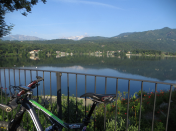
Start at the lakeside in Avigliana (360 m), take the paved road that climbs to the Sacra di San Michele and then left to the junction for the convent of San Francesco, continuing on the paved road to the Combravino hamlet and to the Braida hill (1006 m).
The path to Mt. Ciabergia is not easily visible: go up near the fountain on paved road with wooden fence for about 200 meters, go straight to Prese dei Rossi, turn right after 50 meters and there is a wooden sign for Mt. Ciabergia. The little marked path in 20 minutes leads to the little madonnina of Monte Ciabergia (1179 m). Three trails branch off from here, the one on the way up, one marked and one steep.
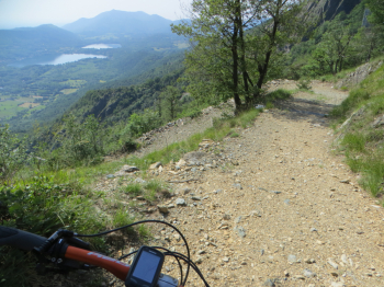
We return to Colle Braida from the uphill trail. Now following the asphalt we reach the Sacra di San Michele (attention, from the Colle Braida to the Sacra, on Saturdays, Sundays and holidays there is a ban on transit in the direction of travel in which you have to face it). From the esplanade we descend a few meters and then reach the dirt road that starts on the right (with the sign Sentiero dei Principi), uphill it reaches a viewpoint, the Punta dell'Ancoccia (benches and table present). From here begins the descent on the Princes' Trail to the Mortera. It is a dirt road about 2 meters wide, with no major technical difficulties (MC).
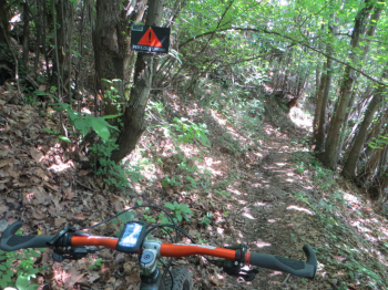
From the hamlet of Mortera you turn left and, after a few meters, you will find another wooden sign, Sentiero dei Principi, leading to the hamlet of Bertassi. This trail alternates between a first BC section and a second, hollowed-out, OC section: there is a sign for danger of nails and logs placed crosswise by bikers ascending (I passed three of them). Also intercepted a group of 35 hikers from Veneto, obviously with precedence. Overall this is a nice technical trail. When you reach the asphalt you turn left and in a couple of kilometers you are back at the starting point.
Fraternali Map No. 4 scale 1:25,000 Lower Susa Valley, Musinè, Sangone Valley, Rivoli Hill.