
 Italiano
 Deutsch
Mount Cadria m 2250, Bochet de Zori
 This is an extreme cyclo-mountaineering tour, not in terms of elevation gain or length but in terms of extreme steepness of the pedaled section, long push and shoulder sections with very steep, exposed and slippery slopes. Descent with long exposed sections, several to be done on foot (some sections are equipped with metal cables). Good motivation, confident pace and riding, and a little bit of craziness required.
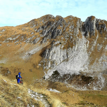
That said, the beauty of the environment, rugged and wild, the grand panorama and the open-air museum of the Great War make this place truly special.
Ascent
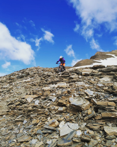
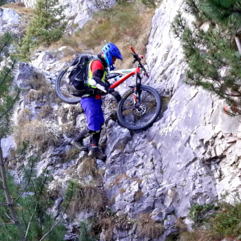
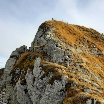
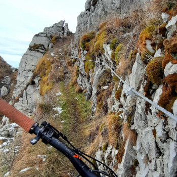
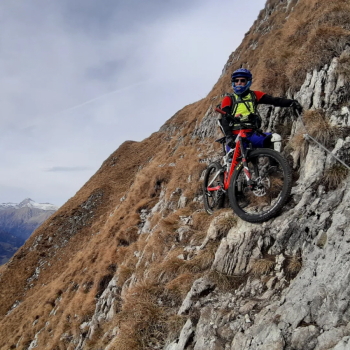
Depart from Lenzumo (small parking lot), along Val Concei. Just past the small village turn left up the very steep Valle dei Molini on first asphalt, then concrete with natural sections. Never giving up a meter, it pays to take the deadly climb very philosophically. At 1560 you reach the pleasant meadow of malga Vies, the end of the pedaling. Turning right, climb up a wide, rocky path pushing and shoving the bike, reaching, at 1915 meters malga Cadria, located almost at the edge of a wide basin dominated by the steep spurs of Cadria. We continue by reaching and following a beautiful half-hill path that leads under the very steep final slopes of Mount Cadria, which we climb by shouldering the bike with much effort and great delicacy. At about 2150 you reach a first barely visible fork, turn left (you could also go straight) to reach the western ridge. Now you face the most delicate, steep, exposed and slippery uphill section WARNING!!!!!!. Reaching a ledge you breathe a sigh of relief and a few meters ahead you reach the EE trail equipped with steel cables. In a short time you reach the airy, panoramic summit. It is a great sight.
Descent
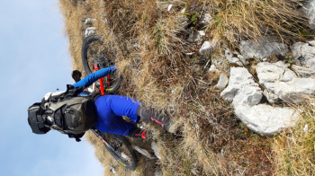
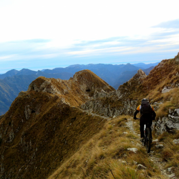
Follow the EE-equipped ridge trail among the incredible Great War military emplacements carved into the bold rocky spires, with only a few bikeable sections; be very CAUTION because it is extremely exposed.
Once in the basin below malga Cadria we ride back along the easy, stony uphill path to malga Vies (halfway up take a short, more interesting variant to the right).
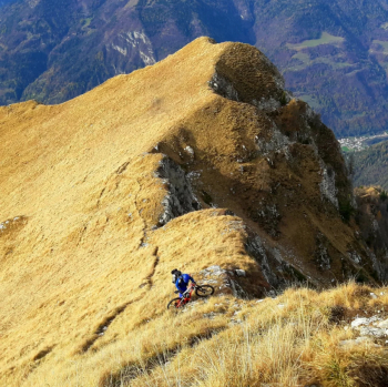
At the malga we continue straight on to Monte Vies the path soon becomes narrow with exposed sections (be careful) and some up and down, we climb a total of a hundred meters that are anything but cyclable, uncomfortable uncomfortable. The descent to the Bochet de Zori begins at about 1650 elevation in a very un-cyclable mode (some military posts are notable). When you finally climb in the saddle, more or less around 1400 meters, a narrow little path in the steep forest, with a few switchbacks and a few drops leads to the Bochet de Zori, m 1174. A few meters up and then down, along a fun, steep trail in the woods that ends directly at the first houses of Lenzumo.