Italiano
 Deutsch
Red Spire Periplo - counterclockwise

Periplo di Guglia Rossa we call it as an alternative to better known tour of Col de Thures, as previously there has been that of Mount Morion and Testa di Comagna.
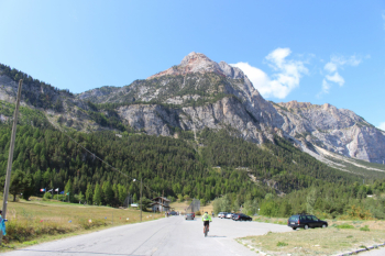
This time there are three of us, with die-hard ski mountaineers Giovanni and Nicolò, an incredibly cold early September morning even at 8:45 a.m. forcing us to start in a jacket or long sleeve from Pian del Colle and do quite a bit of road climbing before warming up. No sunshine to speak of either, almost to the Col de Thures.
We arrive with some effort in the vicinity of the Refuge 3 alpini, after gaining 400 m elevation gain on asphalt we need to stop and refresh, and Nicolò adds a kway to his clothing, stating a malandrine breeze.
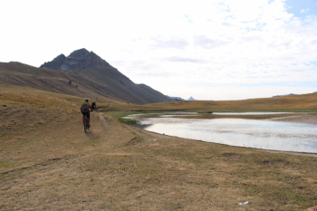
And in the meantime we enjoy the spectacle: two on trial motorcycles with a huge basket on their backs are loaded with live fish by a gentle damsel and such trout poured into the not far green lake.
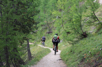
We set off again with enthusiasm, curbed almost immediately by the killer ramp before the Refuge that should take us with sections on foot and in the saddle to the pass. In fact the first part is very poorly cyclable, only after about 2000 elevation does it level out a bit.
At last we see hikers heading toward the Red Spire, a huge herd quickly heading toward Lake Chavillon or Thures,
First part of the descent very easy and not very steep in the meadows to the Chalets de Thures with some donkeys grazing placidly. After a net a first steep section invites slow going, then it softens to a fork at about 1900 m elevation where we opt for the droite route to the Chalet Forestier with a nice mix in the forest of loose stones never too steep.
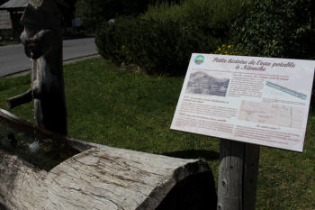
Arrived in Nevache, fountain a must, it's up again on asphalt (there is a small variant on path before the village, but without water), up to the Col and then down again on asphalt to a right fork that, past some fallen trees, allows us to arrive near the cars on path.
At 1 p.m. we are at the car, ready for the food stop.
Fraternali publisher no. 21 - Briancon, Vallée de la Guisane, Vallée de la Clarée Trail map (1:25,000)


Red Spire from Lake Chavillon
Nevache
Red Spire climbing to the ladder pass from Nevache