Italiano
 Deutsch
Verzegnis - M.Verzegnis

N.B the original track does not close in Verzegnis because due to storm I had turned off the gps in Pusea. Changing the track would not be counted by training camp, I have attached the track up to Pusea, going back up on asphalt easily closes the loop.
This route has a special significance, starting from Villa di Verzegnis, one of the four hamlets where the settlement of the Marzona family results since the early 1600s.
I set off on August 15, 2021 at 6 a.m. by bike from Villa di Verzegnis with concern about a possible encounter with bear Francesco mitigated by a 500-gram jar of honey in my backpack.
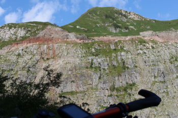
First stretch of asphalt climb along the route of the glorious Verzegnis - Sella Chianzutan car race. Apart from an ebike that passed me at three times the speed nothing to report on this stretch, the only water point being the fountain below casera Marzona. Beyond this hour of asphalt it takes another two-plus hours to ride the dirt road, terrain that over the years has seen a little partial initial asphalting and crumbling of the red marble pebbles, which after three-quarters of the way leads to casera Presoldon or Presaldon and after a few challenging tears to the tunnel and marble quarry. In this section the major evidence was the intersection with the forest ranger descending and signaling that bear Francesco with radio collar on August 15 was stationed in Sauris, so honey was superfluous. Four paths converge from the square, the old tracks with tunnel to the cable car, the narrow grassy path that we will take on the way back, the wide dirt road to casera Val, and finally the dirt road to the quarry.
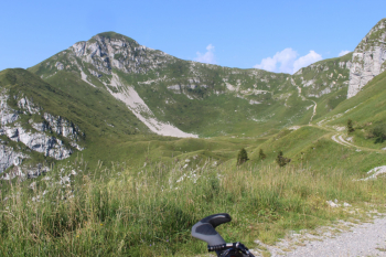
We descend for about a km to casera Val where we leave the mtb and continue on foot to forcella Cormolina and then to the grassy ridge with a final climb. The walking section is suitable as an experienced hiker and takes about 45 minutes uphill and about as long to descend. Unfortunately, Ferragosto 2021 was not a very clear day and then we will see what happens next.
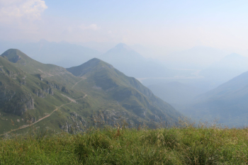
Resumed the mtb, climbed back up to the quarry to take the former grassy 806 trail rideable to the bottom of the little valley. Followed by section around rocks, rideable but exposed, and then descent with OC and then BC section in beech forest to sella Chianzutan. Descent in an hour or so. Water stop at cousins' house and then continuation on trail 811 to Avrint hut, another 45 minutes uphill. Meanwhile thunder could be heard from overhead. Before the last bend to the right for the malga, continue on turf to the thicket with the sign bivacco Carcadè bivouac junction for trail 827. It begins to pour and what is worse to flash. First section on foot and then riding at full speed over foliage to Pusea. Never was the sight of a tent with a table of 10 people more welcome! A glass of water other satisfaction! After half an hour the sky clears, I resume asphalt uphill, descend to Verzegnis Lake and return home. Skipped the mid-August barbecue, but operation accomplished, too bad I didn't calculate the elevation gain and the storm, but that's one of the unpredictability of Carnia and the Carnians. Mandi to all.
Topographic map Prealpi Carniche Val Tagliamento Ed. Tabacco scale 1:25,000