
 Italiano
 Deutsch
2022/08/22 13:40:47
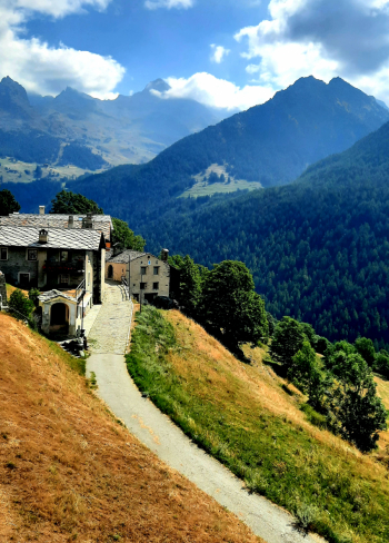
Champoluc
Author

Place
Italy - Valle d'Aosta, AO
Km
22,30 km
Elapsed time
05:21:59
Vertical meters
+468 mt (1503 - 1727)
Route difficulty
Landscapes
Last update
2022/08/22 13:40:47
Comments
Description
Itinerary without technical difficulties, on secondary or dirt roads, but with beautiful views of glaciers and the Champoluc valley. The historic villages of Saint Jaques, Antagnod and Lignod are visited.
Graph
Nearest Routes
19,82 km
Km
+989 mt
Vertical meters
Route difficulty
Landscapes
16,23 km
Km
+931 mt
Vertical meters
Route difficulty
Landscapes
19,73 km
Km
+1 385 mt
Vertical meters
Route difficulty
Landscapes
2023/08/27
- Italy - Valle d'Aosta, AO 32,17 km
Km
+1 969 mt
Vertical meters
Route difficulty
Landscapes
2022/10/18
- Italy - Valle d'Aosta, AO 31,51 km
Km
+2 400 mt
Vertical meters
Route difficulty
Landscapes
22,09 km
Km
+1 233 mt
Vertical meters
Route difficulty
Landscapes
18,02 km
Km
+1 780 mt
Vertical meters
Route difficulty
Landscapes
26,22 km
Km
+950 mt
Vertical meters
Route difficulty
Landscapes
32,97 km
Km
+1 613 mt
Vertical meters
Route difficulty
Landscapes