
 Italiano
 Deutsch
2022/08/22 14:11:37
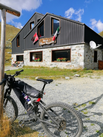
Rifugio Grand Tournalin
Author

Place
Italy - Valle d'Aosta, AO
Km
19,82 km
Elapsed time
08:22:15
Vertical meters
+989 mt (1566 - 2527)
Route difficulty
Landscapes
Last update
2023/01/03 16:53:00
Comments
Description
Itinerary not very long but very enjoyable and in beautiful mountain environment, with fantastic views of Monte Rosa. From the Champoluc parking lot you climb first on asphalt and then on a forest road to the Grand Tournalin refuge. From here take the trail, with challenging but always doable sections, to the village of Saint Jaques, then more trail on the right side of the valley to the parking lot.
Graph
Nearest Routes
16,23 km
Km
+931 mt
Vertical meters
Route difficulty
Landscapes
19,73 km
Km
+1 385 mt
Vertical meters
Route difficulty
Landscapes
2023/08/27
- Italy - Valle d'Aosta, AO 32,17 km
Km
+1 969 mt
Vertical meters
Route difficulty
Landscapes
2022/10/18
- Italy - Valle d'Aosta, AO 31,51 km
Km
+2 400 mt
Vertical meters
Route difficulty
Landscapes
22,09 km
Km
+1 233 mt
Vertical meters
Route difficulty
Landscapes
18,02 km
Km
+1 780 mt
Vertical meters
Route difficulty
Landscapes
26,22 km
Km
+950 mt
Vertical meters
Route difficulty
Landscapes
32,97 km
Km
+1 613 mt
Vertical meters
Route difficulty
Landscapes